We keep hearing all these acronyms that are supposed to make the big long terms they represent easier to understand, but in a world full of acronyms, they can be just as confusing. GPS isn’t really as confusing or overwhelming as it seems, nor is it as miraculous as the forces of the universe being able to pin point you in a world of however many billion people.
GPS stands for ‘global position system’ a construct of somewhere between 24 and 30 satellites that orbit the earth. These satellites transmit radio signal that can be picked up by a GPS receiver such as a Magellan eXplorist or Magellan RoadMate 300. It isn’t magic and nor is it a government conspiracy to track your every move. It is some complex technology being able to put these radio waves together to determine your position on earth.
The type of GPS receiver that you use will determine how this data is interpreted and consequently what it can do for you. For the RV owner there are two relevant categories of GPS receivers; hand held units and in car navigation units. Just to create a little more confusion the term GPS is commonly used to refer to both types of units as well as the actual system that is out there in the far beyond. However each of these units are very different with their very own abilities and limitations.
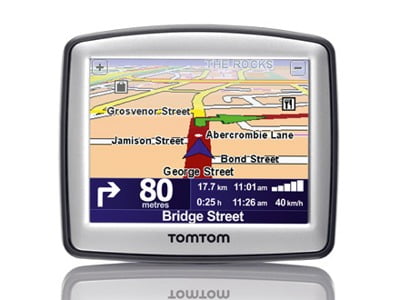
In car navigation units such as the RoadMate 300 are the most commonly known units, providing ‘turn by turn’ visual and vocal guidance from your current position to desired destination. These units are very straight forward and easy to use. The user simply types in their desired street and suburb and as they move the unit will provide the turns to take until the destination is reached. Additionally, the Magellan RoadMate 300 uses geocoded national address fi les (GNAF) taking the user to the exact location of the entered street number, and not just an approximation.
Generally in car navigation units do their best work in the inner city and provide little in the way of mapping out of the city. However, the Magellan RoadMate 300 does have great mapping including roads and streets for all cities, towns and small rural communities, so this one you can take out of the city.
The other category of GPS is ‘hand held’ receivers such as the Magellan eXplorist series. So called because they are generally small enough to fi t in your hand, completely portable and made of rugged construct allowing you to take them into any environment or condition. Unlike in car navigation units, hand held units are not primarily designed to simply tell you how to get to a friends house, but instead provide you with navigation tools and safety features, allowing you to navigate on road or off the beaten track anywhere in Australia.
So if it isn’t magic how does it actually work? When you turn on your eXplorist 400, 500, 600 or XL, the GPS unit will locate your position in the world. By scrolling through the ‘nav’ screens you can view your position in a number of different ways; latitude and longitude, distance to destination, direction to destination, or location on a map.
The favourite way to view position is on the map screen, where you can see where you are on a map of the local area. You can also zoom in and out to show more or less map detail and surrounding information. If you are using a Magellan eXplorist 400, 500, 600 or XL you can upgrade the mapping to DiscoverAus Streets & Tracks Topo, providing you with highways, streets, tracks, four wheel drive trails, waterways, topographic map contour lines and thousands of points of interest for all of Australia.
So when it comes to actually using the unit to navigate you have a couple of options. You can choose a destination by entering a latitude and longitude, typing in a street address or searching for a point of interest or waypoint you have entered yourself. When you have selected where you are going and press ‘go to’ the unit will draw a line from your current location to your destination. It doesn’t have to be your fi nal destination, but a stop over point along the way. It is then up to you to navigate the route you want to take using the mapping available on the unit.
Travelling this way is great for seeing the sights and not being afraid to detour to a tourist attraction at any point.
The unit will beep at you to let you know if you are getting too far from the direction you should be heading with the compass screen always able to point you in the right direction and provide distance to destination (as the crow flies).
However, if travelling like this isn’t precise enough for you, you can plan a route before you leave home by placing a series of waypoints to travel to along the way. The new MapSend Lite V2 PC viewing software is available as a free download and allows you to view your topo maps on the big screen of your PC, which you
can use to plan your routes and download to your GPS. You can save all of these routes and waypoints in your GPS so you can return to them at any time.
The fi nal option is just to wing it. You still use the maps on your GPS but make decisions as the next road approaches. You can feel safe knowing that regardless of which road you take or method you choose to navigate an electronic breadcrumb trail will be left behind you so you can always turn around and fi nd your way home. Again using MapSend Lite V2 you can upload the route you took (track log) to your PC and view it on a two or three-dimensional map, actually watching the car travelling up and down each and every hill you travelled on.
Using a Magellan eXplorist hand held GPS with DiscoverAus Streets & Tracks Topo mapping you can safely navigate your way through big cities, small outback towns and bush tracks in the middle of nowhere. You don’t have to just type in an address and listen to someone boss you around with each turn you have to take to make good time. Uses a Magellan eXplorist hand held GPS and make your travels a real adventure!